Silvia Nittel joined the Editorial Board of the new open-access journal “IoT” (MDPI).
IoT (ISSN 2624-831X) is an international peer-reviewed open access journal published quarterly online by MDPI.
Silvia Nittel joined the Editorial Board of the new open-access journal “IoT” (MDPI).
IoT (ISSN 2624-831X) is an international peer-reviewed open access journal published quarterly online by MDPI.
Today, Michael Cressey successfully presented his M.Sc. project titled “Spatio-Temporal Fields over Real-time Sensor Streams Using Spark” (advised by Silvia Nittel), and graduated with an M.Sc. in Spatial Information Science & Engineering.
Congratulations, Mike!


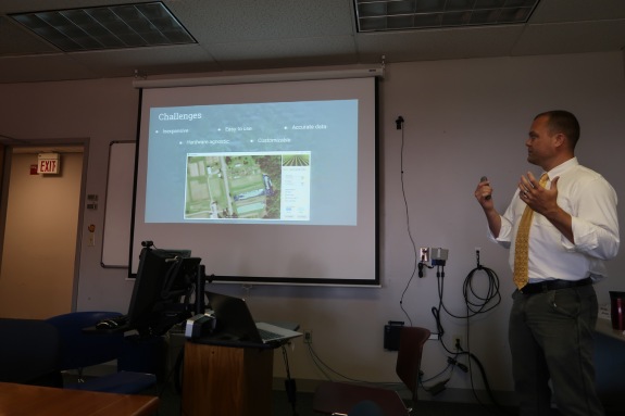
This summer, Nick Mowry presented his Master’s project that focused on designing and implementing an inexpensive hardware and software system that allows small farmers to track labor costs across farming small plots. The core system idea is to track a farm worker who wears a GPS device such as a sport watch and analyze the resulting trajectories based on how much time the worker spent on different plots on the farm. This information can be correlated to the crops grown in these areas of the farm, and thus, labor cost can be calculated. Now, farmers can determine the overall cost of growing a crop compared to the current market prices for this crop.
Nick built a prototype of the system using Garmin watches, MySQL, Google Maps and MS Visual Studio. A demo of the system is available via the link below.

![]()
Our $6 Mio NSF EPSCOR grant “Leveraging Intelligent Informatics and Smart Data for Improved Understanding of Northern Forest Ecosystem Resiliency (INSPIRES)” has been approved for funding this August. The grant is led by Aaron Weiskittel, Umaine Forestry, and includes colloboration with the University of New Hampshire and Vermont.
Dr. Nittel is Senior Personnel in the Environmental Informatics and Advancing sensing research areas.
INSPIRE Scope:
Forests are an economically important and ecologically critical component of New England’s working landscape. Local and regional communities depend on the health of these forest ecosystems to support biodiversity, conservation, recreation, and a forest-based workforce. New England’s forests are also highly dynamic and diverse due to a wide variety of complex factors, including changing environmental conditions, varying management objectives across Federal, state and private land ownership, and natural disturbances. Despite advances in technology and the better acquisition of forest-related information, critical forest data remains highly varied, inconsistently available, and relatively coarse in scale.
The INSPIRES project will leverage expertise and facilities across the University of Maine, University of New Hampshire, and University of Vermont campuses to build a digital framework that will better assess, understand, and forecast complex forest changes. The integration of emerging computational, monitoring, remote sensing, and visualization technologies into a Digital Forest Big Data framework will provide comprehensive, near real-time spatial and temporal measurements of the forest at levels readily usable by scientists, land managers, and policy makers. Another objective of this project is to strengthen workforce development and broaden participation in STEM education, particularly among students with diverse backgrounds and skills.
The project will accomplish both its digital and educational aims by drawing from a broad array of established programs and disciplines, including data science, ecology, electrical engineering, computer programming, and communications. Furthermore, faculty and students will collaborate on the development of a regional Complex Systems Research Institute that will facilitate ongoing analysis of forest ecosystem integrity and resilience from multiple scientific perspectives. Ultimately, this Big Data Framework integrating advanced sensing and computing technologies, environmental informatics and analytics, ecological modeling, and quantitative reasoning skills would be applicable to other forested regions and ecosystems. Most importantly, this effort will help support and sustain northern New England’s unique forested landscape, which many rural communities rely on for their livelihoods.
In August 2019, Silvia Nittel has joint the Editorial Board of the ISPRS Open Access International Journal of Geo-Information.
Our paper “Real-time Mapping of Natural Disasters Using Citizen Update Streams”, Iranga Subasinghe, Silvia Nittel, Michael, Cressey, Melissa Landon and Prashanta Bajracharya, has been accepted for publication in the International Journal of Geographical Information Science in the Special Issue “Real-time GIS for Smart Cities” (published in July 2019).
We built a multiagent simulation system to create social media update streams during a natural disaster, and use the 2018 Montecito mudslides as a scenario to extensively test which update characteristics, citizen participation and citizen movement characteristics contribute to the quality of being able to map a disaster purely on citizen update streams in real-time.
This video shows our work modeling the mudslide as a spatio-temporal event used as input for the multiagent system.
Abstract:
Natural disasters such as flooding, wildfires, and mudslides are rare events, but they affect citizens at unpredictable times and the impact on human life can be significant. Citizens located close to events can provide detailed, real-time data streams capturing their event response. Instead of visualizing individual updates, an integrated spatiotemporal map yields ‘big picture’ event information. We investigate the question of whether information from affected citizens is sufficient to generate a map of an unfolding natural disaster. We built the Citizen Disaster Reaction Multi-Agent Simulation (CDR-MAS), a multi-agent system that simulates the reaction of citizens to a natural disaster in an urban region. We proposed an rkNN classification algorithm to aggregate the update streams into a series of colored Voronoi event maps. We simulated the 2018 Montecito Creek mudslide and customized the CDR-MAS with the local environment to systematically generate stream data sets. Our experimental evaluation showed that event mapping based on citizen update streams is significantly influenced by the amount of citizen participation and movement. Compared with a baseline of 100% participation, with 40% citizen participation, the event region was predicted with 40% accuracy, showing that citizen update streams can provide timely information in a smart city.
Gearing up to the final project in SIE559: Geosensor networks — building a mesh network with Arduino Unos, Xbee radios, sensing end nodes, and an actuating Christmas tree light.


As part of a research paper on real-time volunteer streams we used the 2018 Montecito Mudslide as our driving scenario this summer. Mike Cressey, a grad student in the SIE program, did most of the work of modeling the mudslide using the RAMMS software from Switzerland (under the supervision of Dr. Melissa Landon, Department of Civil Engineering). There were actually 4 different mudslides, and we modeled the Montecito Creek one.
Mike summarized the work and shows the animation in the following video:
Our article “Real- time inverse distance weighting interpolation for streaming sensor data” (Q. Liang, S. Nittel, J.C. Whittier, and Sytze De Bruin) has been published in Transactions of GIS. It is available as pre-print online (link). (TGIS2018_liang_nittel)
Abstract:
With advances in technology and an increasing variety of inexpensive geosensors, environmental monitoring has become increasingly sensor-dense and real-time. Using sensor data streams enables real-time applications such as environmental hazard detection, or earthquake, wildfire or radiation monitoring.
In-depth analysis of such spatial fields is often based on a continuous representation. With very large numbers of concurrent observation streams, novel algorithms are necessary that integrate streams into rasters or other continuous representations continuously in real-time.
In this paper, we present an approach leveraging data stream engines (DSEs) to achieve scalable, high-throughput Inverse Distance Weighting (IDW). In detail, we designed and implemented a novel stream query operator framework that extends general-purpose DSEs. The proposed framework includes a two-panel, spatio-temporal grid based index and several algorithms, namely the Shell and k-Shell algorithms, to estimate individual grid cell efficiently and adaptively for different sampling scenarios. For our performance experiments, we generated several different spatio-temporal stream data sets based on the radiation deposits in the Fukushima region after the nuclear accident in 2011 in Japan. Our results showed that the k-Shell algorithm of the proposed framework produces a raster based on 250K observations streams in under 0.5 seconds using a state of the art workstation.
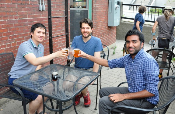
Yesterday, he submitted the final version of his PhD thesis to the grad school, and now is ready for new adventures. Time for some congratulatory beers with Qinghan Liang and Iranga Subasinghe at the Orono Brewing Company.
